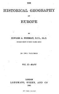
The Historical Geography of Europe, Vol. II, Maps by Edward A. Freeman
"The Historical Geography of Europe, Vol. II, Maps" by Edward A. Freeman is a scholarly historical account, published in the late 19th century. This volume serves as a companion to the first, focusing primarily on a detailed examination of geographical changes across Europe through various time periods, utilizing maps as a core means of representation of historical developments. This volume contains a rich array of maps that illustrate significant phases of European
history, highlighting transformations in territorial boundaries and the influence of various powers from the ancient Greeks and Romans to the early modern period. The maps encompass critical events such as the growth of the Roman Empire, the division of lands after the reign of Charles the Great, and the impact of various treaties leading to changes in Southeastern Europe. Each map is designed to provide a visual understanding of the geopolitical landscape, allowing for a better grasp of how historical events shaped the Europe we recognize today. (This is an automatically generated summary.)
Read or download for free
| Reading Options | Url | Size | |||
|---|---|---|---|---|---|
| Read now! | https://www.gutenberg.org/ebooks/61376.html.images | 69 kB | |||
| EPUB3 (E-readers incl. Send-to-Kindle) | https://www.gutenberg.org/ebooks/61376.epub3.images | 46.2 MB | |||
| EPUB (older E-readers) | https://www.gutenberg.org/ebooks/61376.epub.images | 46.1 MB | |||
| EPUB (no images, older E-readers) | https://www.gutenberg.org/ebooks/61376.epub.noimages | 46 kB | |||
| Kindle | https://www.gutenberg.org/ebooks/61376.kf8.images | 39.3 MB | |||
| older Kindles | https://www.gutenberg.org/ebooks/61376.kindle.images | 39.3 MB | |||
| Plain Text UTF-8 | https://www.gutenberg.org/ebooks/61376.txt.utf-8 | 27 kB | |||
| Download HTML (zip) | https://www.gutenberg.org/cache/epub/61376/pg61376-h.zip | 50.5 MB | |||
| There may be more files related to this item. | |||||
Similar Books
About this eBook
| Author | Freeman, Edward A. (Edward Augustus), 1823-1892 |
|---|---|
| Title | The Historical Geography of Europe, Vol. II, Maps |
| Credits |
Produced by Susan Skinner and the Online Distributed Proofreading Team at www.pgdp.net |
| Reading Level | Reading ease score: 59.7 (10th to 12th grade). Somewhat difficult to read. |
| Language | English |
| LoC Class | D: History: General and Eastern Hemisphere |
| Subject | Europe -- Historical geography |
| Category | Text |
| EBook-No. | 61376 |
| Release Date | Feb 11, 2020 |
| Most Recently Updated | Oct 17, 2024 |
| Copyright Status | Public domain in the USA. |
| Downloads | 410 downloads in the last 30 days. |
| Project Gutenberg eBooks are always free! | |

