
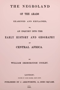
The Negroland of the Arabs examined and explained : or, an inquiry into the…
QR code
"The Negroland of the Arabs examined and explained" by William Desborough Cooley is a historical-geographical study written in the mid-19th century. It reconstructs the early geography and political landscape of Central/Western Africa (“Negroland”) from medieval Arabic sources, focusing on caravan routes, river courses, and the true location of key states such as Ghana. The work argues—against earlier misreadings—that medieval Ghana lay near the later site of Timbuktu, and it scrutinizes Arabic texts
with a method that separates firsthand observation from later system-building. The opening of the work dedicates the essay to Pascual de Gayangos, credits his Arabic extracts as its spur, and sets out a preface that defines the aim: to fix the early geography of Central Africa by critically reading Arab writers (especially El Bekri, with Ibn Khaldun, Ibn Battuta, and Idrisi compared), while guarding against copyist errors, name-corruptions, and conjectural mapping. The introduction outlines two natural trans-Saharan corridors—Fezzan to Kanem/Bornu in the east and, more crucially here, the western route from the Atlas/Sus to the “Great River”—and explains why Andalusian-Arab ties to Almoravid Berbers made the western line the best documented. Cooley then uses El Bekri’s “Book of Roads and Realms” to retrace the caravan path from Sijilmasa via Támedelt across a sequence of wells and mountain passes into the belt of drifting sands (the desert of Tíser/Azawad), where Masufa guides and Zenaga tribes (Lumtuna, Goddala) dominated. He identifies Aulil, the coastal salt and ambergris outlet, with Arguin, and locates Aoudaghost on the southern desert margin as a Berber trading colony later eclipsed by shifting routes. The analysis of distances and bearings leads to the core claim: Ghana’s capital—comprising the paired towns of Aukar (Muslim) and Ghaba (royal, pagan)—stood near the northwestern bend of the “Nile of the Blacks,” close to the future Timbuktu. The river’s described course from Silla northeast to “Ras el Ma,” then east and south to Kawkaw, with Tademekka on the desert edge, anchors this placement and frames Ghana’s relations with neighboring Tekrur and other riverine markets. (This is an automatically generated summary.)
Download for free
For your e-reader or reading app — Kindle, Kobo, Apple Books, Calibre etc.
Kindle → Use Send-to-Kindle
Kobo, Nook etc. → Transfer via USB
Phone, tablet or computer → Open in a reading app
Other formats & older devices
There may be more files related to this item.
About this eBook
| Author | Cooley, William Desborough, 1795?-1883 |
|---|---|
| LoC No. | 05008624 |
| Title | The Negroland of the Arabs examined and explained : or, an inquiry into the early history and geography of Central Africa |
| Original Publication | London: J. Arrowsmith, 1841. |
| Credits | Galo Flordelis (This file was produced from images generously made available by Google and the Bibliothèque nationale de France/Gallica) |
| Language | English |
| LoC Class | DT: History: General and Eastern Hemisphere: Africa |
| Subject | Sudan (Region) -- Historical geography |
| Category | Text |
| eBook-No. | 78434 |
| Release Date | Apr 13, 2026 |
| Copyright | Public domain in the USA. |
| Downloads | 436 downloads in the last 30 days. |
Project Gutenberg eBooks are always free!